Garmin ECHOMAP UHD2 7" sv Chartplotters 74sv with GT54UHD-TM Transducer and Garmin Navionics+ U.S. Coastal & Great Lakes Mapping (010-02685-01)
Garmin ECHOMAP UHD2 7" sv Chartplotters 74sv with GT54UHD-TM Transducer and Garmin Navionics+ U.S. Coastal & Great Lakes Mapping (010-02685-01)
SKU: 010-02685-01
Bajas existencias
 Ver todos los detalles
 WhatsApp
 SMS - Text us!
 Email Us!
 Help Desk
Reseñas
Especificaciones
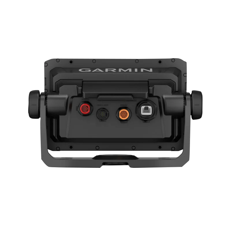
En la caja
GT54-TM transducer
Power cable
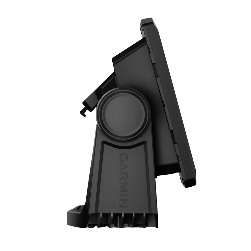
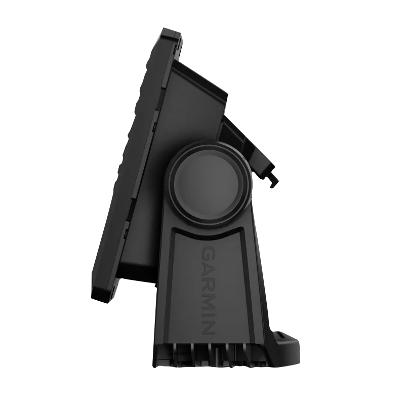
Tilt/swivel mount with quick release cradle
Protective cover
Hardware
Documentation
Manual y garantía
 Garmin Warranty
¿Tiene una unidad GPS vieja por ahí? El programa Trade In and Up de GPS Nation es una excelente manera de canjear su GPS viejo y usado por crédito para un nuevo GPS. ¡La decisión es completamente suya! Hemos simplificado y optimizado el proceso. Siga estos sencillos pasos y estará en camino de recibir crédito para su nuevo GPS.
1. Obtenga una cotización
Para obtener una cotización gratuita, proporcione el tipo, el fabricante, el modelo y el estado de su GPS. En un plazo de 24 horas, recibirá una cotización por el valor de intercambio de su producto actual. El formulario de intercambio de GPS se encuentra en la parte inferior de esta página.
2. Envíe su(s) producto(s) para comercializarlos
Después de aceptar nuestra oferta, empaquete sus productos de forma segura y envíenoslos utilizando la etiqueta de envío prepaga que le proporcionamos. Le enviaremos un correo electrónico de confirmación cuando su canje llegue a nuestro almacén. Tiene 30 días a partir de la fecha en que complete su canje en línea para enviar el producto a GPS Nation.
3. Realiza tu compra
Una vez que recibamos su producto en nuestro almacén y validemos la condición indicada, le enviaremos un correo electrónico de confirmación. Si elige recibir crédito para un nuevo GPS en gpsnation.com, se emitirá su crédito de la tienda y podrá realizar su compra.
Reseñas
Haz una pregunta
Especificaciones
En la caja
GT54-TM transducer
Power cable
Tilt/swivel mount with quick release cradle
Protective cover
Hardware
Documentation
Manual y garantía
Programa de canje
¿Tiene una unidad GPS vieja por ahí? El programa Trade In and Up de GPS Nation es una excelente manera de canjear su GPS viejo y usado por crédito para un nuevo GPS. ¡La decisión es completamente suya! Hemos simplificado y optimizado el proceso. Siga estos sencillos pasos y estará en camino de recibir crédito para su nuevo GPS.
1. Obtenga una cotización
Para obtener una cotización gratuita, proporcione el tipo, el fabricante, el modelo y el estado de su GPS. En un plazo de 24 horas, recibirá una cotización por el valor de intercambio de su producto actual. El formulario de intercambio de GPS se encuentra en la parte inferior de esta página.
2. Envíe su(s) producto(s) para comercializarlos
Después de aceptar nuestra oferta, empaquete sus productos de forma segura y envíenoslos utilizando la etiqueta de envío prepaga que le proporcionamos. Le enviaremos un correo electrónico de confirmación cuando su canje llegue a nuestro almacén. Tiene 30 días a partir de la fecha en que complete su canje en línea para enviar el producto a GPS Nation.
3. Realiza tu compra
Una vez que recibamos su producto en nuestro almacén y validemos la condición indicada, le enviaremos un correo electrónico de confirmación. Si elige recibir crédito para un nuevo GPS en gpsnation.com, se emitirá su crédito de la tienda y podrá realizar su compra.
Descripción general
Garmin ECHOMAP UHD2 7" sv Chartplotters 74sv with GT54UHD-TM Transducer and Garmin Navionics+ U.S. Coastal & Great Lakes Mapping (010-02685-01)
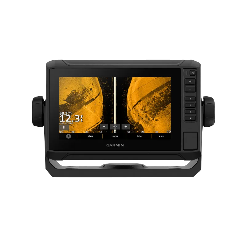
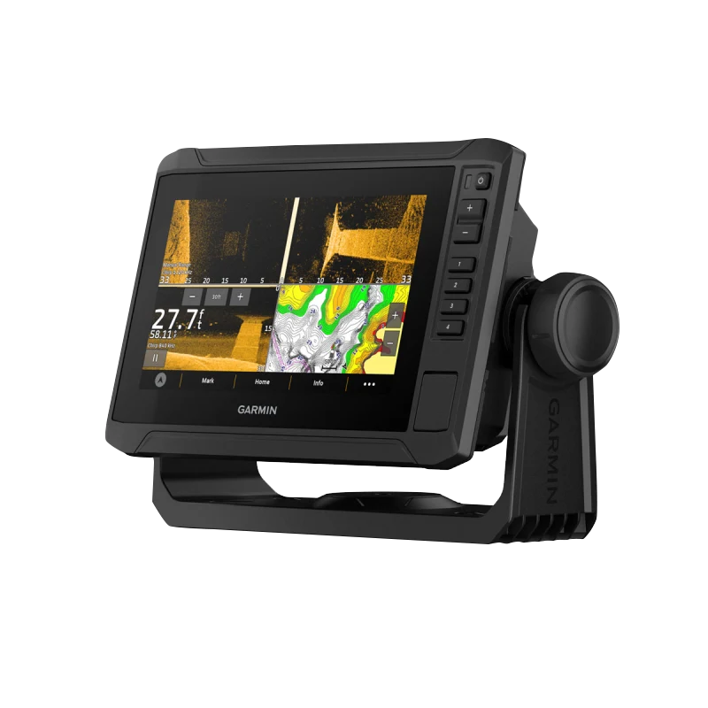
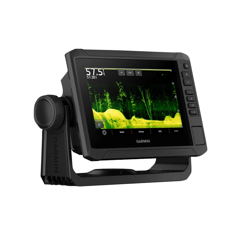
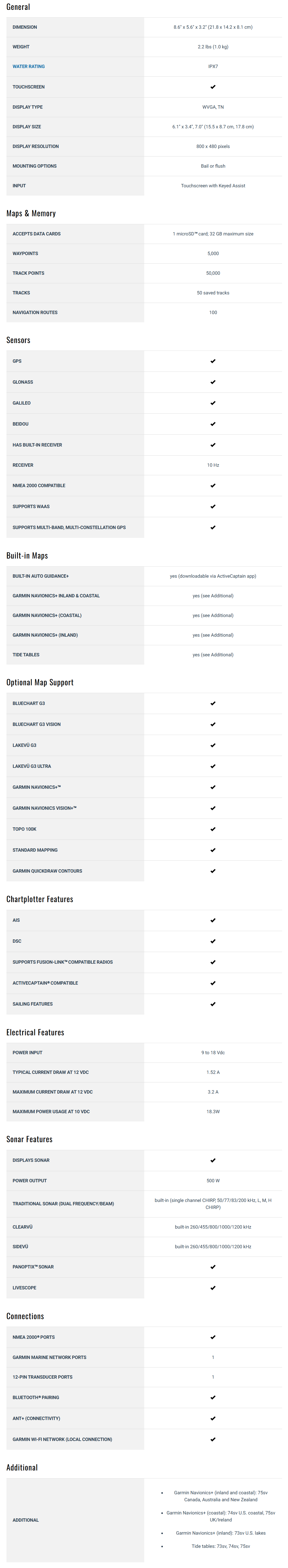
The Garmin ECHOMAP UHD2 7” sv Chartplotter (74sv with GT54UHD-TM Transducer) is a feature-rich, high-performance navigation and sonar system designed for serious anglers. Equipped with a premium touchscreen display, cutting-edge sonar technology, and advanced mapping capabilities, this chartplotter gives you a significant advantage on the water.
Key Features:
- 7” Touchscreen with Keyed-Assist: A bright, user-friendly touchscreen with physical buttons for added convenience and control.
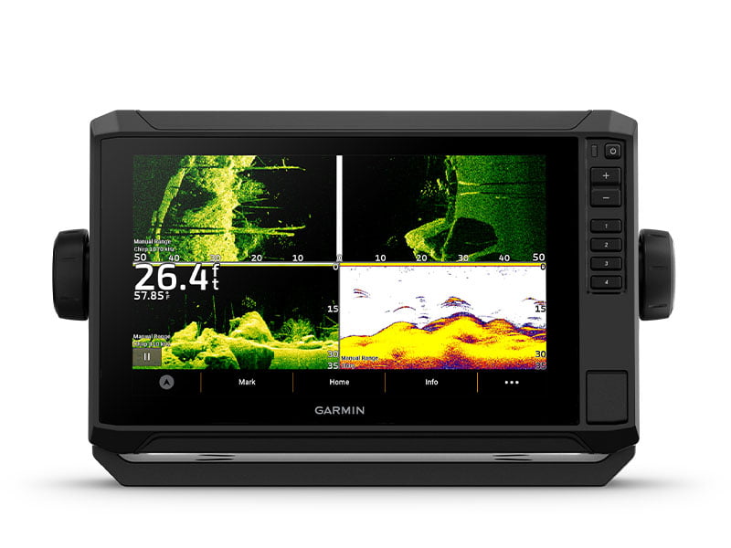
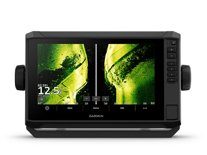
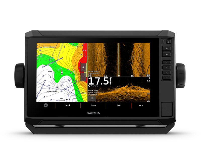
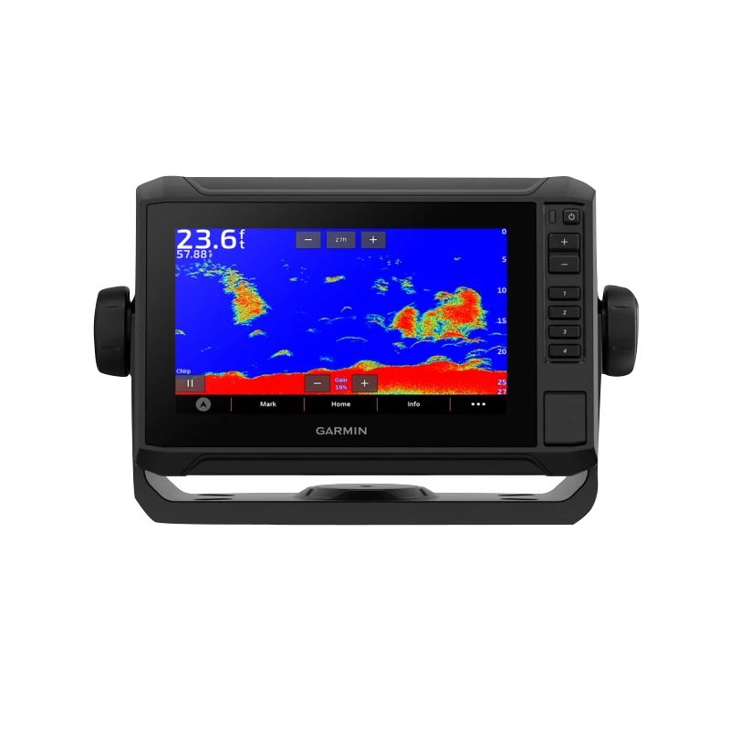
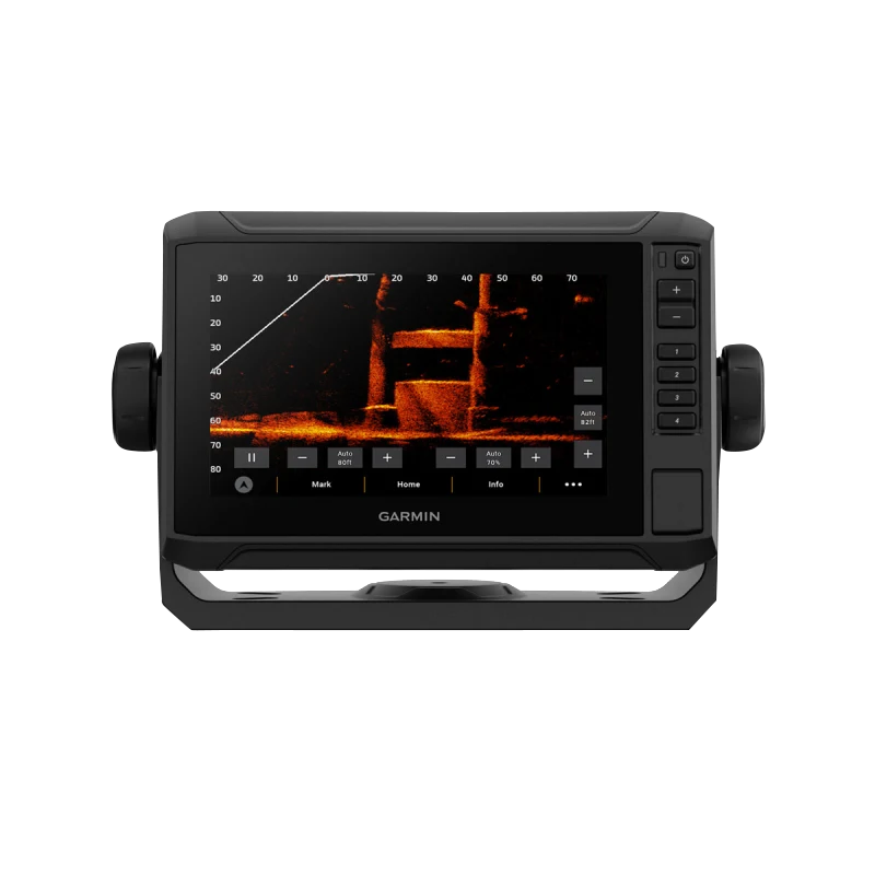
- Triple Sonar Compatibility: Supports Garmin traditional, ClearVü™, and SideVü™ sonar technologies, delivering superior underwater detail.
- GT54UHD-TM Transducer Included: Comes with a GT54UHD-TM transducer, offering Ultra High-Definition sonar imaging for precise fish and structure identification.
- LiveScope™ Sonar Support: Compatible with LiveScope™ real-time scanning sonar, providing unmatched clarity of fish and surroundings.
- Vivid Color Palettes: High-contrast vivid scanning sonar color palettes enhance target visibility for easier identification.
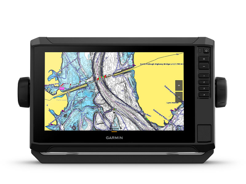
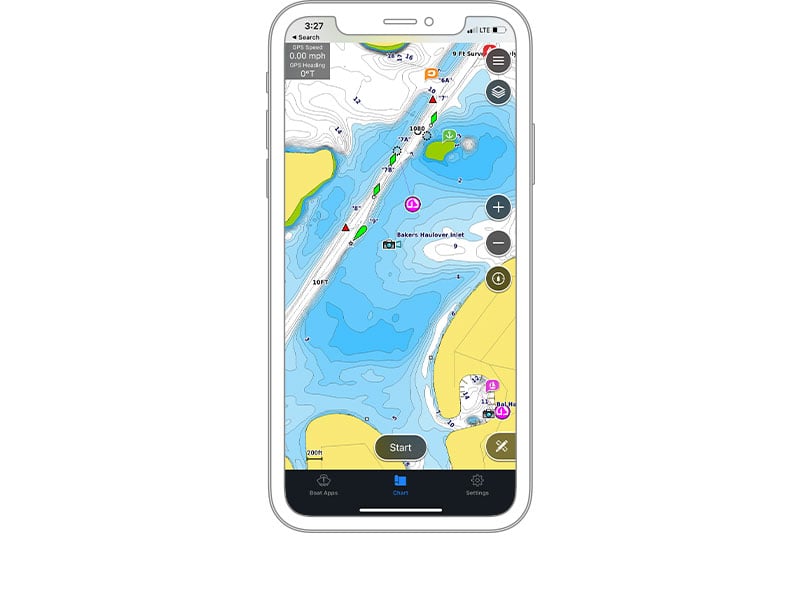
- Preloaded Garmin Navionics+ U.S. Coastal & Great Lakes Mapping: Includes built-in Garmin Navionics+ cartography with a 1-year subscription for daily updates, depth range shading, and more.
- Wireless Networking: Share sonar, waypoints, and routes with other compatible ECHOMAP UHD2 chartplotters on your boat.
- ActiveCaptain® App Integration: Built-in Wi-Fi® connectivity pairs with the ActiveCaptain app, allowing access to OneChart™, smart notifications, software updates, and Garmin Quickdraw™ Community data.
- Auto Guidance+™ Technology: Chartplotters with Garmin Navionics+ charts can download Auto Guidance+ technology for real-time automated route planning via the ActiveCaptain app.
- Force® Trolling Motor Compatibility: Wirelessly connects to Garmin Force trolling motors for easy waypoint navigation, speed control, and boat positioning.
- Power-Pole® Integration: Network with Power-Pole shallow water anchors for smart anchor auto-deployment, jog functions, and enhanced boat control.
- Charge Integration from Power-Pole: Monitor and manage battery power allocation, emergency starts, and energy transfer directly from the chartplotter display.
- Multi-Band GPS: Provides enhanced location accuracy, even in areas with weak or reflected GPS signals.